View larger map
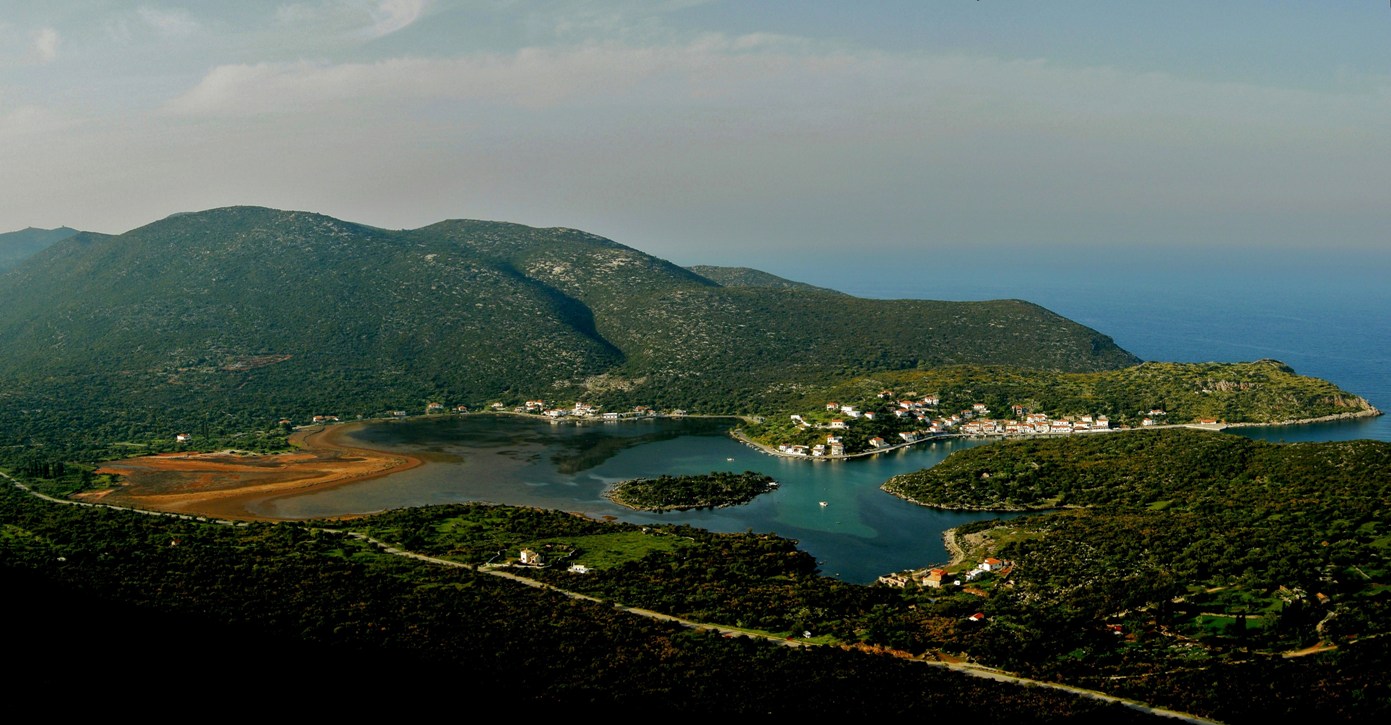
This brief but very interesting and easy route beings on the coast road in the port of Gerakas in an open parking lot where there are signs to the archaeological site of Zarakas.
Take the cement road uphill to the highest houses in the village. From there, a path leads to the ruins of the ancient city, mainly consisting of the remnants of walls. From the edge of the walls a cliff overlooks the entrance to the natural harbour which is invisible from the sea. It is said that the mouth of the harbour was once blocked by a chain to prevent hostile ships from entering this sheltered bay.
Another path within the site leads to an old ruined building which was probably a church, dating from later times. From there, a path leads from the edge of the site to the cemetery and back down to the picturesque port of Geraka.
.
| Category | Mountain trek | |
| Route | Circular | |
| Length (m) | 1,840 | |
| Terrain (m) | Path | 986 |
| Unsurfaced road | – | |
| Surfaced road | 854 | |
| Altitude (m) | start | 2 |
| finish | 2 | |
| Altitude (m) | lowest | 2 |
| highest | 60 | |
| Slope (average %) | – | |
| Overall direction | – | |
| Difficulty | 1 (1-5)  |
|
| Signposts | NO | |
| Beauty | 4 (1-5) |
|
| Drinking water | YES | |
| Vegetation | 3 (1-5) |
|
| Display the route via Google Earth |
||
 |
||